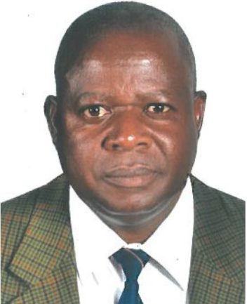
Prof Galcano Canny Mulaku
Galcano Canny Mulaku is Professor of Geospatial Engineering in the School of Engineering, University of Nairobi, Kenya. He holds a B.Sc (Surveying & Photogrammetry, University of Nairobi, Kenya, 1978), Postgraduate Diploma (Photogrammetry, ITC, Netherlands,1982), M.Sc (Surveying Engineering, University of Calgary, Canada, 1987) and Ph.D (Surveying Engineering, University of New Brunswick, Canada, 1995). He was born in 1955 at Emakwara village of Busia County in Western Kenya and is married with four grown up children.
Activities in Education
Prof. Mulaku has been involved with higher education for nearly 40 years and has mentored and graduated many students at the University of Nairobi, the Kenya Polytechnic and the Survey of Kenya training school. His current area of academic interest, in which he has extensively published, is cadastre / land information management / spatial data infrastructure. At the University of Nairobi, he has previously served as Chairman of the Department of Geospatial & Space Technology (1998 – 2001) and Dean of the School of Engineering (2003 – 2005). In university governance, Prof. Mulaku served as a member of the Governing Council of Meru University of Science & Technology from 2009 to 2017. Prof. Mulaku represents the University of Nairobi on the Eastern Africa Land Administration Network (EALAN) and is also the current (2017-2018) chairman of the network.
Activities in Research and Projects
Outside academia, Prof. Mulaku is a Full Member of the Institution of Surveyors of Kenya and a Licensed Surveyor in Kenya. He has participated in some key local and international consultancy assignments such as the Kenya Land Policy formulation process, the Kenya School Mapping Project, the Mozambique Land Administration Improvement Project, the Rwanda land reforms, the World Bank Kenya Land Governance Assessment Framework, etc. He is the current Chairman(2017-2020) of the Kenya Bureau of Standards TC168 on geoinformation standards. Prof. Mulaku has received an award from the International Federation of Surveyors (FIG) for his service to the Surveying profession.
Sample of Publications
Mwange C.M., Mulaku G.C. and Siriba D.N. : Reviewing the status of spatial data infrastructure s in Africa Paper published in the Survey Review journal, Dec. 2016
Wawa, A. and Mulaku, G.C. : Noise Pollution Mapping in Nairobi, Kenya. Paper published in the Journal of Geographic Information System , Vol.7
Baariu, S.N. and Mulaku, G.C. : Mapping Khat (Miraa) by Remote Sensing in Meru County, Kenya, Paper pulished in the International Journal of Remote Sensing Applications Vol. 5
Mulaku, G.C.: Professionalism in GIS : International aspects of the Certification Debate, Paper published in the Journal of Geographic Information System , Vol.5, No.4
Siriba, D.N., Voss, W. and Mulaku, G.C. : The Kenyan cadastral system and modern land adminisration, Paper published in ZfV (Zeitschrift fur Geodasie, Geoinformation und Land Management) Journal (Germany),Vol,136, No.3

